

Interregional Expedition as Part of the Field Practice of the Department of Physical Geography and Cartography
.jpg)
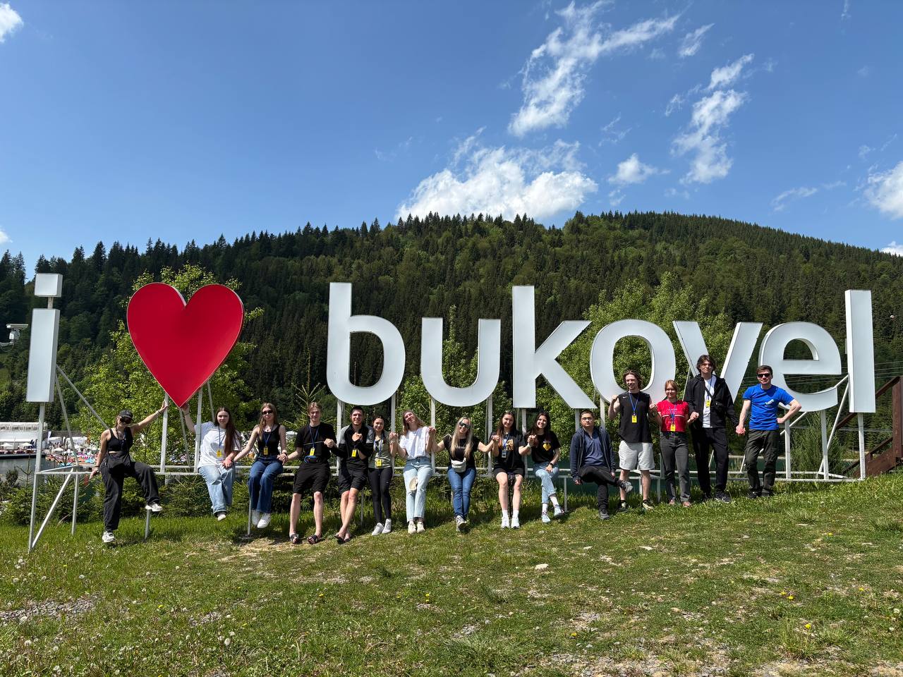
From June 1 to 8, 2025, as part of the industrial and professionally oriented educational practices, students pursuing higher education in specialty 106 "Geography" under the educational programs "Geography", "Cartography, Geographic Information Systems and Remote Sensing of the Earth", "Physical Geography, Monitoring and Cadastre of Natural Resources", "Cartography, Geoinformatics and Cadastre", and "Recreational Geography and Tourism" took part in the Interregional Expedition “Chornohora–2025”.
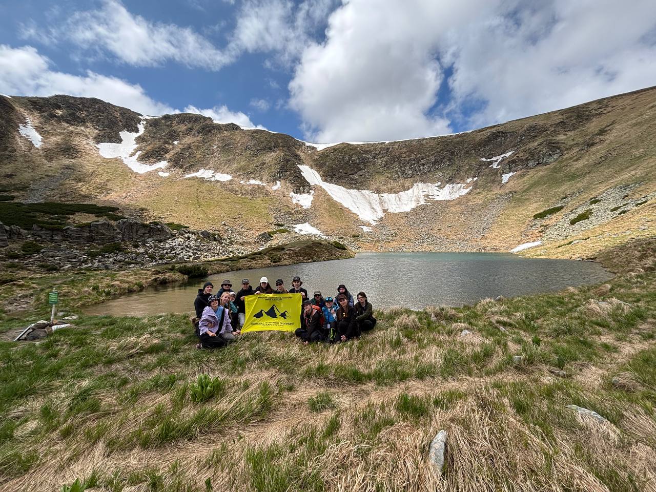
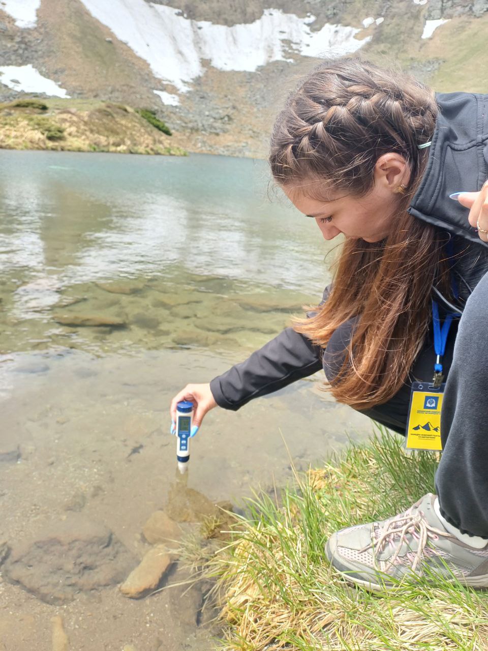
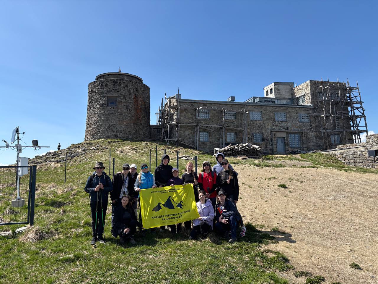
This was geography in action — including ascents to all the two-thousanders of the highest massif of the Ukrainian Carpathians: Petros, Rebra, Hutyn Tomnatyk, Brebeneskul, Pip Ivan Chornohorskyi, and Hoverla; exploration of hydrological objects, in particular, the highest-altitude lake in Ukraine — Brebeneskul; a visit to the tourist cluster of Bukovel; and an excursion to the geographical center of Europe in the village of Dilove, Rakhiv district, Zakarpattia region.
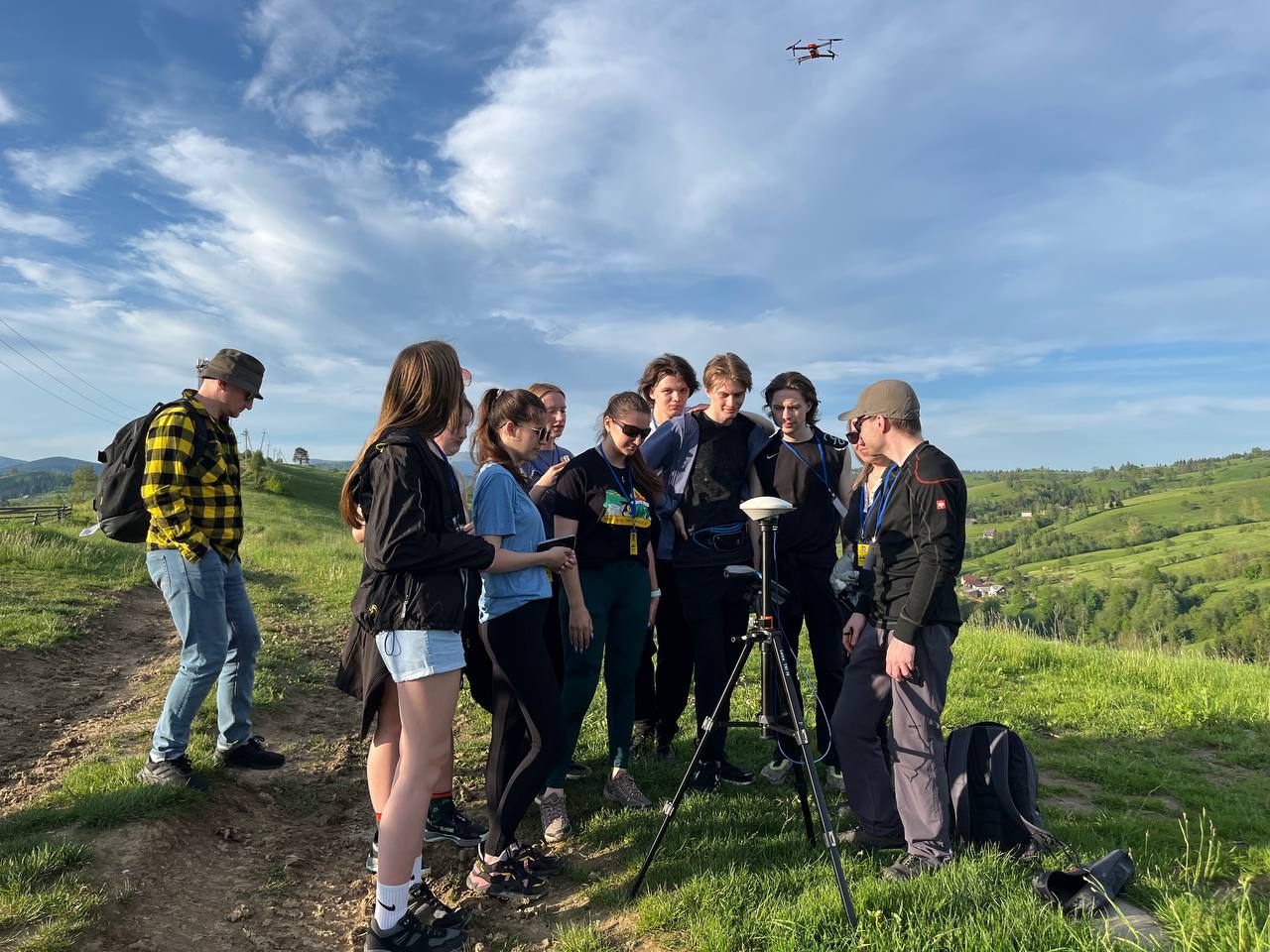
During the practice, a modern approach to spatial data collection using GNSS technology was implemented, with access kindly provided by colleagues through cooperation with the Institute of Geodesy of Lviv Polytechnic National University, and thanks to the personal support of the Institute’s Director, Ihor Savchyn.
Special attention was given to systematic field data collection using mobile GIS. The students kept digital field journals using the ArcGIS Field Maps mobile application, which allowed them to record coordinates, photographs, weather conditions, and descriptive characteristics of objects in real time, linked to interactive maps. This served as a prime example of a modern approach to geographic observation in the field.
The virtual dimension of the practice was enriched by the use of the ThingLink platform, free access to which was kindly granted by Dr. Simon Hutchinson (University of Salford, United Kingdom). Students created original virtual tours and interactive posters using maps, 3D models, media files, and commentary. This not only enriched the practical experience but also demonstrated the effective integration of classical geography with digital technologies.
It is important to highlight that the expedition was made possible thanks to the initiative of Associate Professor Kateryna Borysenko and Senior Lecturer Vladyslav Popov, who established and developed cooperation with the "Pythagoras" project, which enabled sponsorship and organizational support for this field practice. The result was fruitful collaboration between the department's staff, employers, and students already working in the fields of agribusiness and geoinformation technologies.
This field practice became not only a stage in the educational process but also a powerful expeditionary school of teamwork, research approaches, creative thinking, and professional growth.
%20(1).png)
%20(1).jpg)
.jpg)
.png)
%20(1).jpg)
.png)